
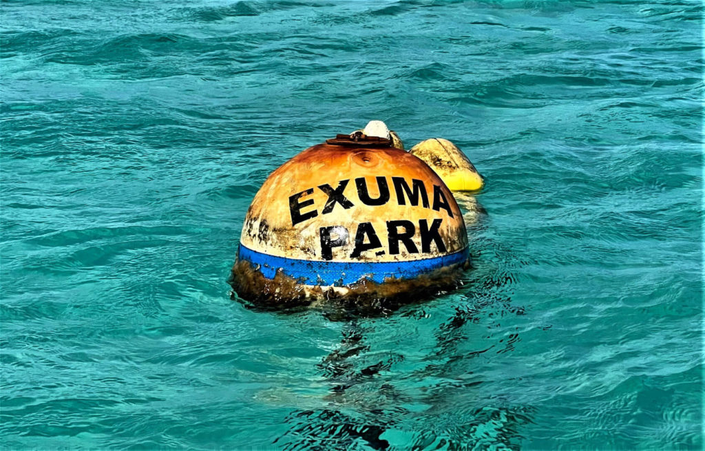
Let’s explore the Exuma Cays Land and Sea Park in the second part of our three-part series on bareboat yacht chartering in the Exuma Cays of The Bahamas. The park is a collection of cays or islands, and the surrounding ocean that spans an area of 22 nautical miles long and 6 nautical miles wide. The islands and waters within this area are protected from development and harvesting by the Bahamas National Trust. There are a few privately owned islands within the park, including Tyler Perry’s White Cay for all you Madea fans out there. Most of the area, however, is controlled by the trust and accessible to the public. Within the park, we’ll cover the following destinations in detail:
Be sure to visit the Bahamas National Trust for more detailed information on the park and an updated fee schedule. Note that when in the park, you must pay a daily fee for moorage, anchoring, and use of the park. When we visited, the fees were: anchoring $0.50/foot, moorings ~$1/foot, and $14 per passenger per day use fee. You can pay cash at the park headquarters on Warderick Wells like we did, or you can pay your fees online. Even more important to note is that you cannot fish or take any artifacts from anywhere within the park boundaries.
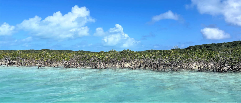
Shroud Cay
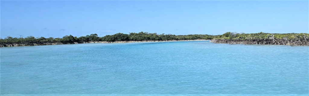
Shroud Cay is a mangrove swamp. As such, you really can’t go ashore. Its known for a number of creeks that flow between the east and west sides of the island, connecting the Exuma Bank to the Exuma Sound.
Anchoring at Shroud Cay
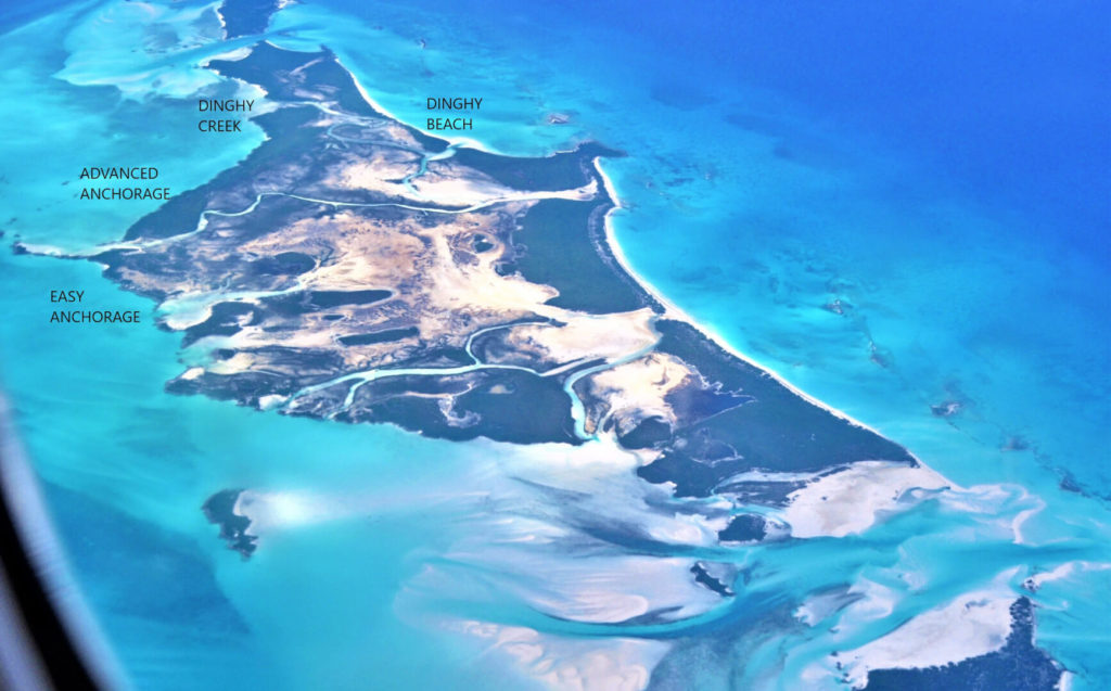
You’ll find several good anchorages on the west side of Shroud Cay. The largest and most popular anchorage is about half-way down the island, south of the long rocky spit that juts out from one of the creeks. Anchored here, you’ll enjoy a beautiful view of the mouth of one of the wider creeks, with a nice sandy beach to boot. You’ll also have the option to pick up a mooring buoy if you’d prefer not to anchor. However, as long as the wind is forecasted to come from the east and not too strong (below 30 knots), I’d recommend taking the opportunity to get more comfortable with your anchor. You’ll be hard pressed to find more ideal anchoring conditions.
You can also anchor to the north of the spit, closer to the dinghy creek. This will shorten your dinghy ride. However, its a bit tighter and you’ll need to navigate around some coral and shallows. You also won’t have the option of a mooring ball on this side.
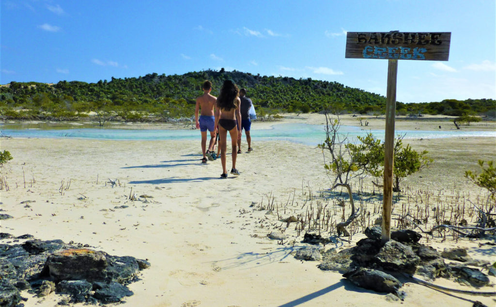
Tips for Navigating the Dinghy Creek
While all of the creeks are ideal for padding, you can only take a motorized dinghy through the northernmost creek. Even then you must go slow enough not to make a wake. The other creeks can be paddled if you brought a kayak or paddleboard.
The creeks are significantly affected by tides, so a rising tide will create current that flows west and a falling tide will flow east. They also get very shallow at low tide, so much so that they can become unnavigable. Enter on a rising tide, at least half-way between the low and high tide times to prevent running aground or banging up your prop. Entering on a rising tide will ensure you have plenty of time to make your return trip before the tide recedes again. We ended up a bit on the early side of the tide and had to tip our engine up and be very mindful of the channel to navigate the creek on the way in. If you’ve got your brown tinted sunglasses on, you’ll be able to follow the darker, deeper parts of the creek.
No need to bring GPS on the dinghy here. At every fork in the creek, go to the left when heading east toward the sound; then right when heading back to your anchorage on the bank.
The channel gets confusing towards the east mouth of the creek where it wide and shallow with lots of sandbars. When you round the last bend and can see the ocean, hug the south or right shore. There’s a sandbar in the convergence of another creek on the right that makes this route appear to be the shallower side. However, if you cross the sandbar, the center channel gets very shallow making it difficult to cross from the left bank to the right bank where you need to be to get to the end of the creek. Once you get to the inlet, you can cross back to the left side to beach your dinghy. If you don’t want to take my word for it, this area is well charted in Navionics, so just be sure to take a look before you head out.
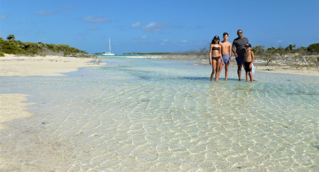
The Real Treasure of Shroud Cay : Beach at the End of the Creek
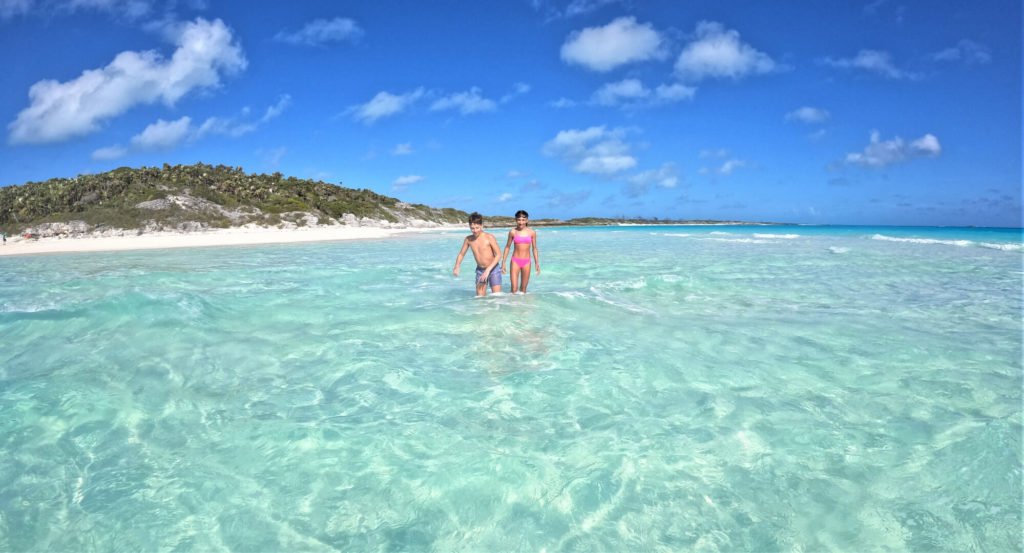
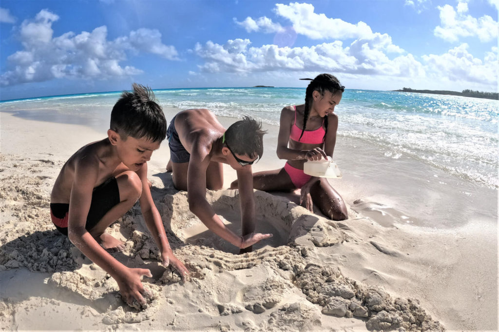
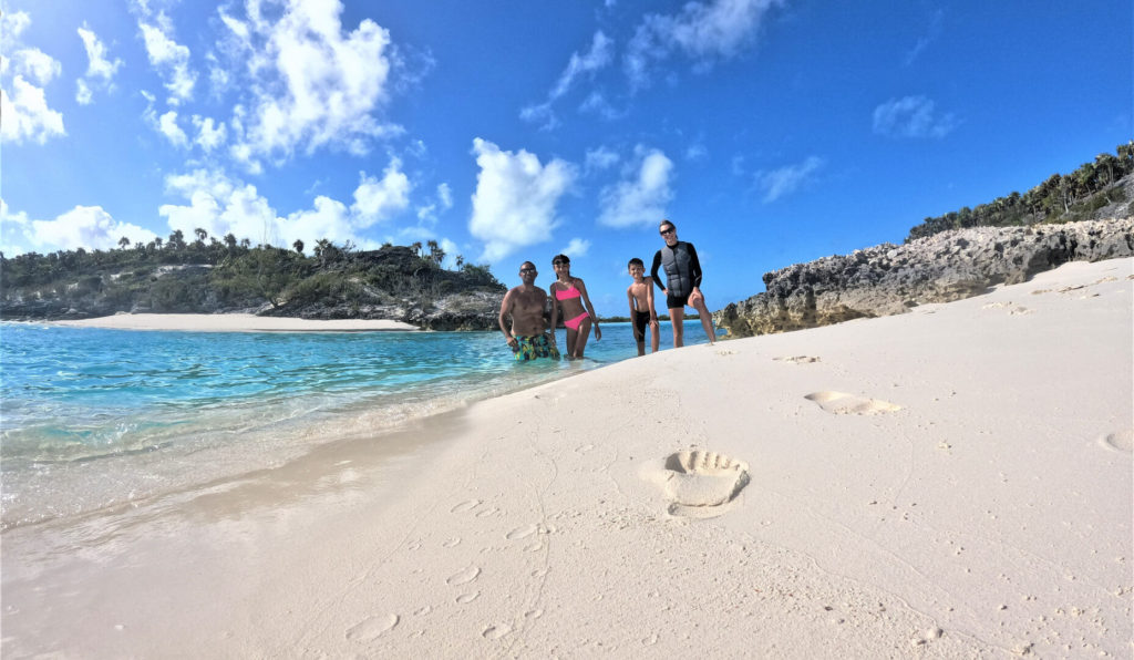
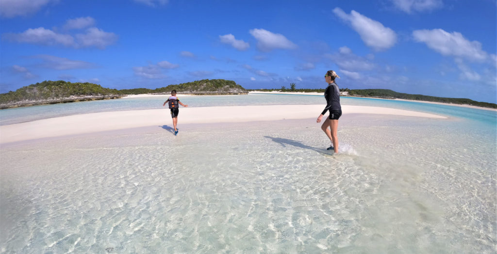
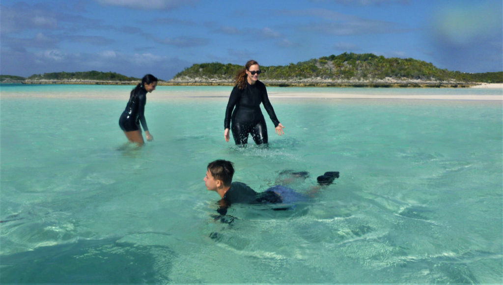
Running the dinghy down the creek was not all that exciting if you ask me, just mangrove after mangrove. The highlight was the beach on the Sound side of the island. The beach has a very shallow entry into the ocean for several hundred yards with a sandbar that runs perpendicular to the creek. This makes for a surprisingly calm beach with gentle waves that is safe for swimming. Even at high tide, you can stand on the sandbar, so there’s no worry of floating out to sea. Depending on the direction of the tide, the current will carry you toward the sandbar or toward the river; it makes for a great lazy float.
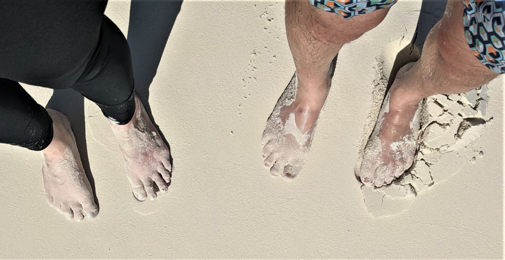
This beach also had the softest sand we’ve ever felt. That may not be saying much since we hail from the rocky west coast, but nonetheless. It was fine almost like powdered sugar.
There are several other creeks on the island that you can explore by kayak or paddleboard. Keep the tide times in mind as you may not want to fight the current to get back to your boat.
Warderick Wells: Headquarters of the Exuma Cays Land and Sea Park
We originally planned to skip Warderick Wells on account of it sounding like some administrative bullshit park office. However, we ended up having some extra time while in the park, so gave it a go. Boy did we luck out by adding it back! This speaks to having a baseline itinerary for your cruise, but allowing flexibility. You don’t know when you’ll spend more or less time somewhere, or have a weather impact that creates the opportunity (or need) for flexibility.
So just how worthwhile is Warderick Wells? We ran into a long-term cruising family on one of the beaches here. They had cruised the entirety of The Bahamas and then came back here to spend several more weeks at Warderick because they liked it so much.
North Mooring Field at Warderick Wells
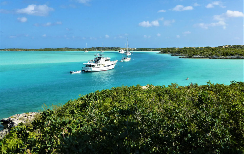
There is a very narrow channel lined with mooring buoys that runs along the north side of Warderick Wells. At low tide, most of the water around the channel dries up, leaving a deep blue vein of water in the channel. It may be the most beautiful water in which to pick up a mooring on planet earth. This mooring field also happens to be well protected on all sides; not just the east (note that in case you run into some nasty weather from another direction). Anchoring in the Exuma Cays Land and Sea Park is not free; it is half the cost of the mooring buoys. So, if you can get a ball in the North Mooring Field, this is the one time all week that I’d recommend it.
Shipwreck at Buouy 19
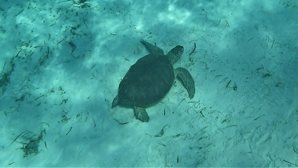
Buouy 19 in the North Mooring Field has a sailboat that caught fire and sunk while on the mooring. It isn’t easy to find from the surface: head toward the mooring ball and look to the Southwest. It’s surprisingly deep given how shallow the water is nearby. In addition to the cool wreck, we saw a beautiful sea turtle, and lots of colorful fish. We also spotted a lemon shark that freaked us out a bit.
Boo Boo Hill Hike
Boo Boo hill is a short, easy, well-marked, hike from the park office to the highest point on the island. There’s lots to see along the trail. You can certainly do this one with flip flops, but a sturdier sandal would be safer. After walking past the park office, there’s a muddy swamp that looks like a planet from the original Star Trek series. Then you’ll wade (ankle deep) through a stunning tidal creek.
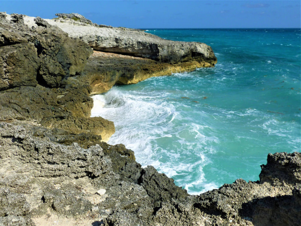
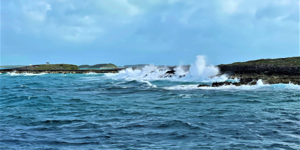
Toward the top of the hill there’s a short detour to the left to see a blowhole. Blowholes are rock formations that allow waves to roll underneath with a hole at the top where the water pressure pushes the water up in the air. When we were there, despite a violent sea, nothing was coming through the spout. This one must be tide dependent, and we were there at the wrong time. Anyway, its a good spot to witness the potential violence of the Exuma Sound if you haven’t crossed a cut to experience it in your boat yet.
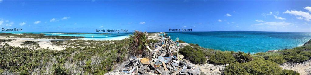
Booboo Hill is one of the highest points in the Exuma Cays, making for a beautiful view of both the Exuma Bank and the Exuma Sound. If you’ve got a good telephoto rig, this is a great spot to snap a photo of your boat.
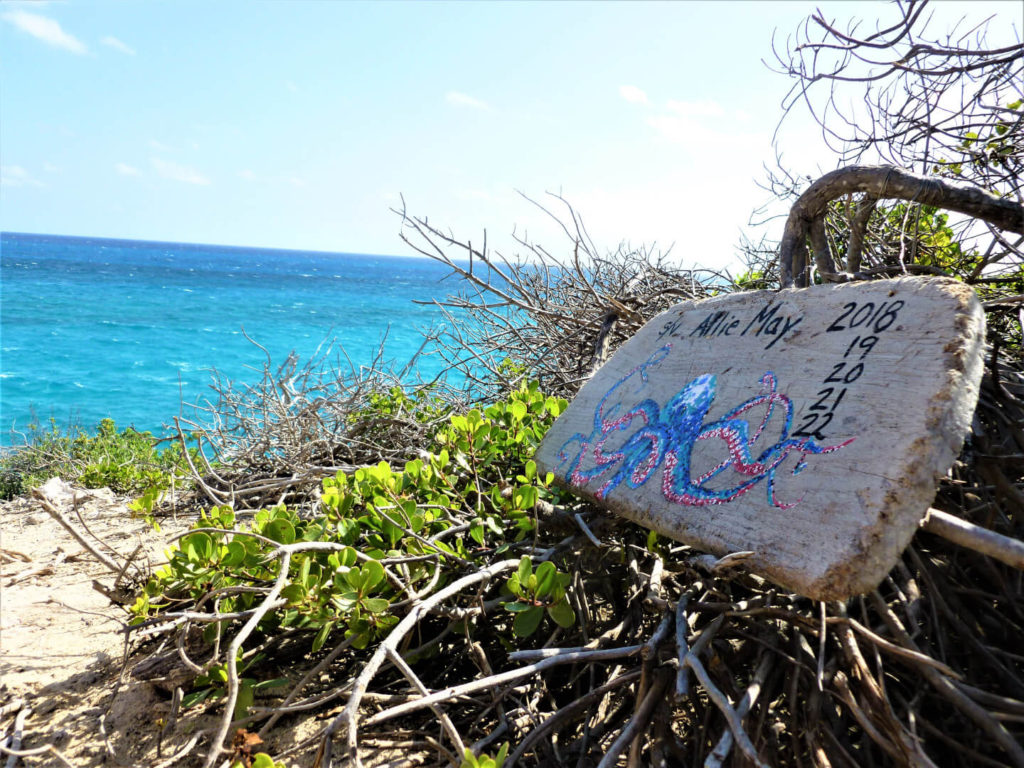
At the top of the hill, cruisers have created a tradition of leaving a piece of driftwood anorned with their boat name atop a pile. The park wardens leave pallets near the dinghy dock for you to do the same. Some cruisers return year after year and mark the occasion.
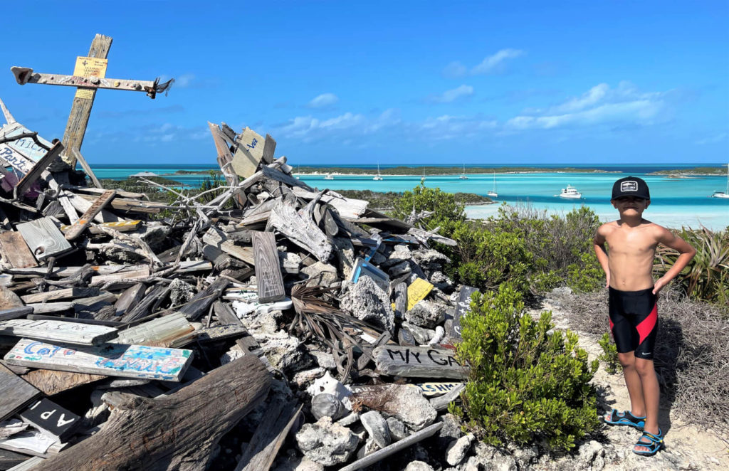
Booboo Hill is the most obvious hike, with the beautiful lookout and proximity to the park office. However, it is one of the shortest hikes on the island. There are miles of other trails to explore throughout the island. A map is available in the park office that highlights the trails and beaches to aid in your exploration.
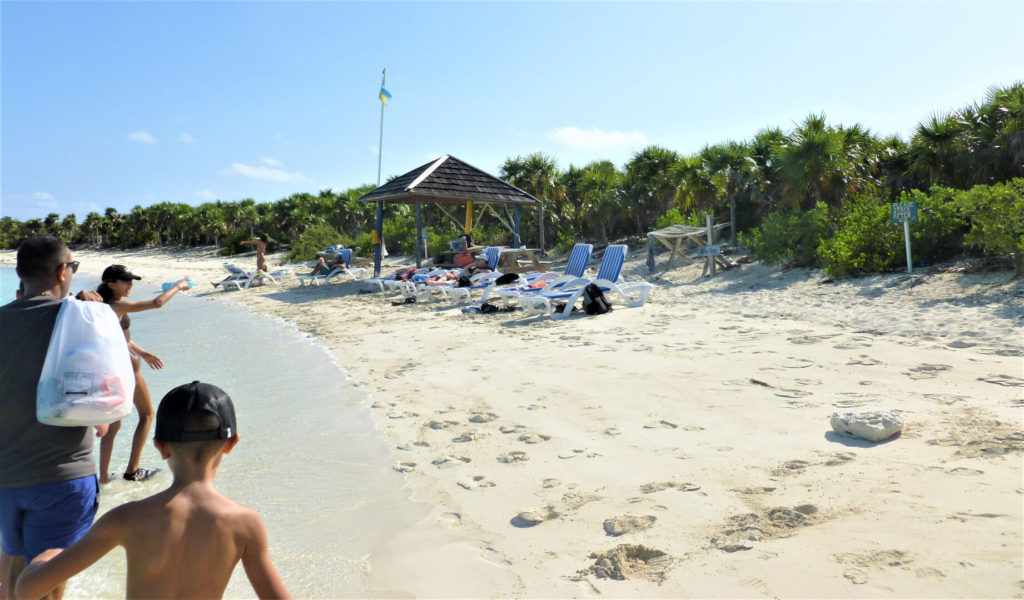
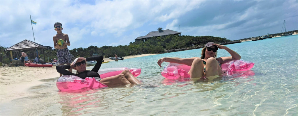
Beaches at Warderick Wells
There are a number of beaches all around the Warderick Wells. So, you can head out on your dinghy to stake out your own private spot. There’s also an almost resort style beach (somewhat unexpected in a ‘park) between the north mooring field and the park office. On this beach, the park wardens have placed beach chairs and umbrellas. This is a great place to meet other cruisers and share notes about what you’ve seen and what you might do next.
Wildlife at Warderick Wells
As a preserve, the Exuma Cays Land and Sea Park is protecting the habitat and hosting the recovery of a number of species both on land and in the sea. You’ll have the opportunity to see a number of these animals throughout the park, but especially at Warderick Wells.
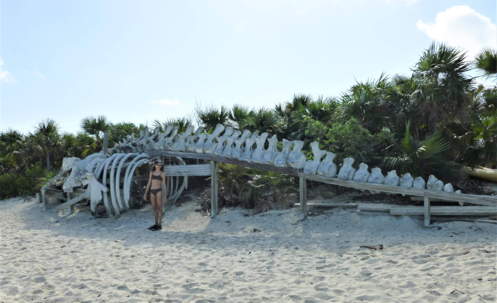
Sperm Whale
Unfortunately, this one isn’t swimming and jumping. The skeleton of a sperm whale that was killed by ingesting plastics lies on the beach near the park office. Keep that in mind while managing the trash on your boat…and when you return home.
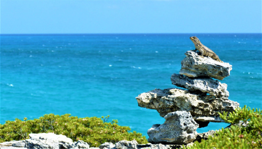
Lizards and Snakes
Throughout the island there were little stacks of rocks. From time to time you’ll come across a lizard basking in the sun on one. We also found a snake sunning in the middle of the path on Booboo Hill. Snakes in The Bahamas are harmless to humans…unless they startle you into a heart attack!
Sea turtles
We found a beautiful turtle swimming near the shipwreck at buoy 19.
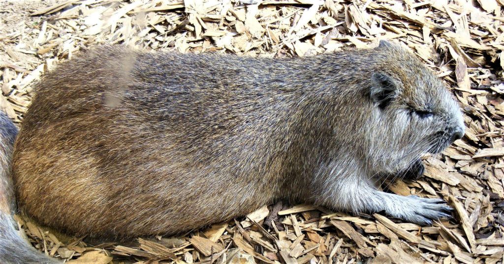
Hutia
We heard about hutia, but are kinda glad that we never ran into one.
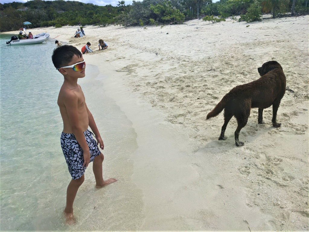
Dogs
Dogs are allowed in the park on the beaches, but not on the trails or the brush. While our dog stayed home, we had a great time playing fetch with this guy.
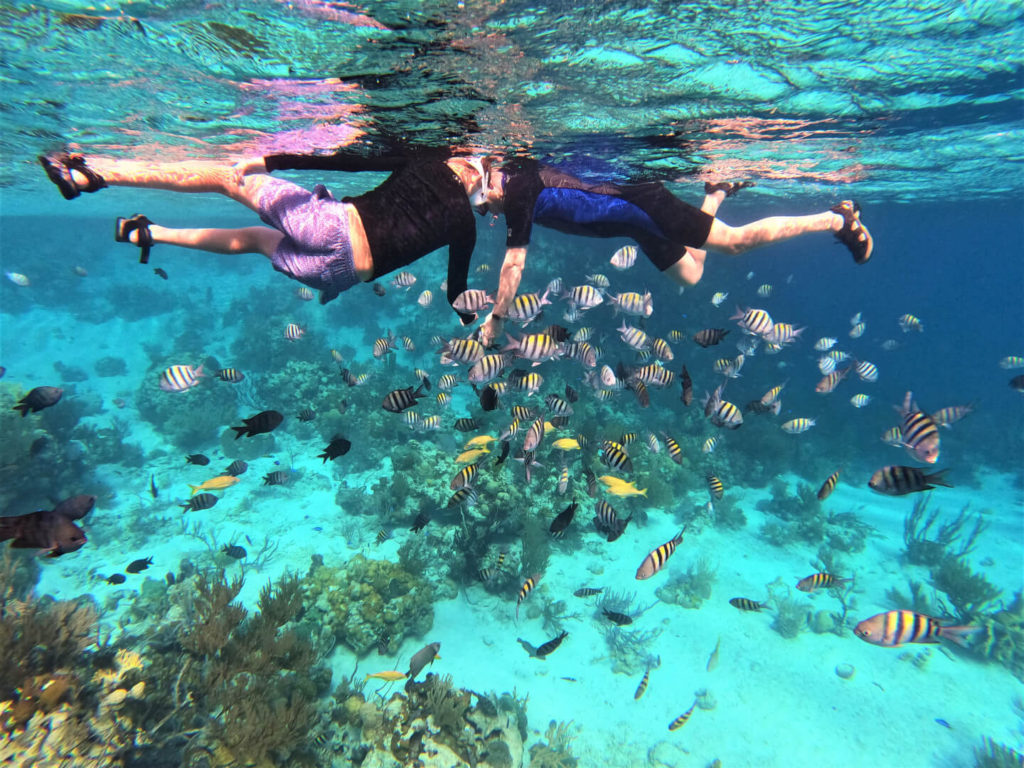
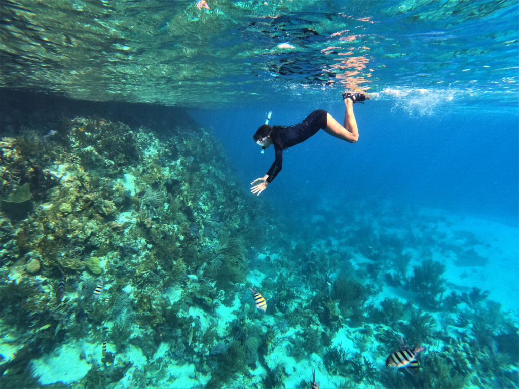
Aquarium
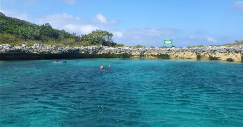
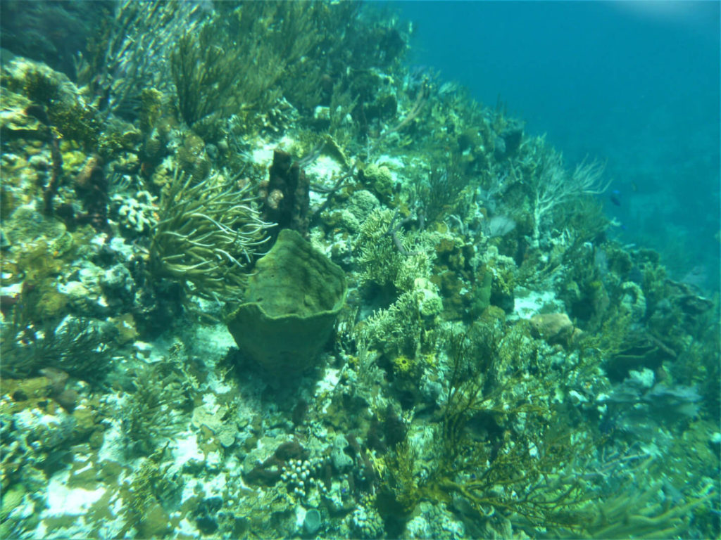
The metaphorically named Exuma Cays Land and Sea Park Aquarium is a very meta experience. It’s a natural ocean that mimics a saltwater aquarium that mimics the natural ocean. A tiny half-moon islet forms the aquarium, protecting a dense collection of coral reefs and tropical fish from the violent ocean lying just to the east.
The Aquarium is very easy to find just off the north edge of O’Brien’s Cay (discussed below). It is well marked on charts; Navionics shows a dive flag. You’ll see two mooring buoys inside a semi-circle island with a green sign atop. It’s pretty tight with lots of coral below; so I’d recommend taking the dinghy…and using the mooring buoys to avoid damaging the coral.
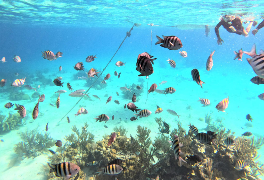
Once in the water, an abundance of tropical fish will surround you on all sides. These fish are very friendly. Almost as if they are used to being fed by snorkelers. If you hold a camera out, they’ll swim right up and pose for a picture.
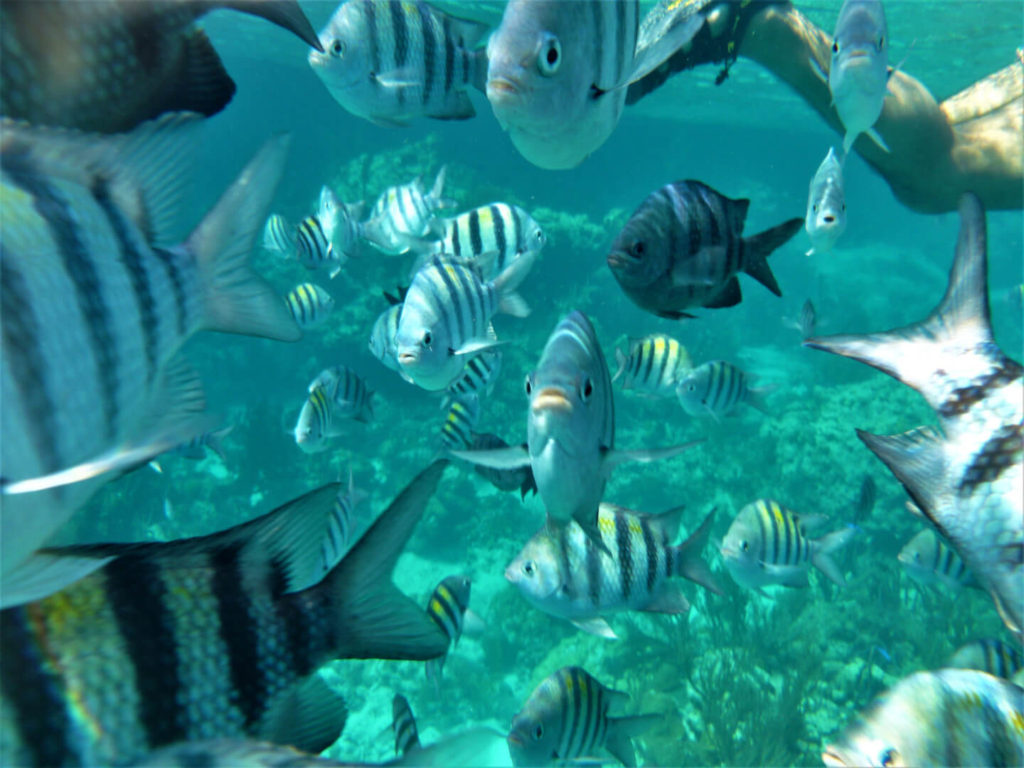
There’s also a beautiful abundance of coral here, both up against the island, and growing on the sea floor.
O’Brien’s Cay
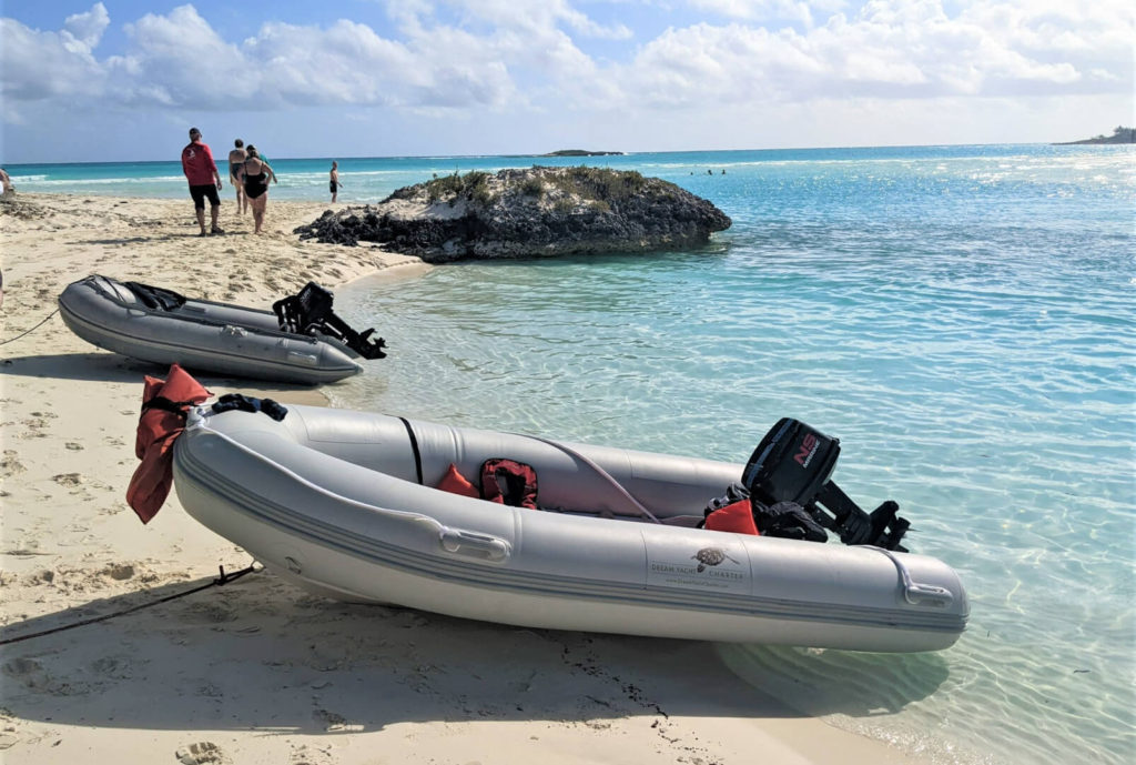
O’Brien’s Cay is one of the southernmost cays within the Exuma Cays Land and Sea Park. It is tucked behind a number of other small cays and sandbars. So it takes a bit of time to slowly navigate your way back to it from the Exuma Bank. When we departed O’Brien’s Cay, we decided to save some time getting to our next destination (North to Warderick) by going out into the Exuma Sound. This was necessary to make it to Warderick before sunset. However, it was a horrifyingly rough ride. You can read more about that experience here.
You’ll find a great anchorage along the west side of O’Brien’s Cay. It is protected on all sides by several other islands. If you’ve got a shallow draft hull like we did (3.5 feet), you can tuck right in between O’Brien’s Cay and Pasture Cay. Anchoring is a bit more ideal just north of Pasture Cay. You’ll find more space, more depth, and even a few mooring buoys.
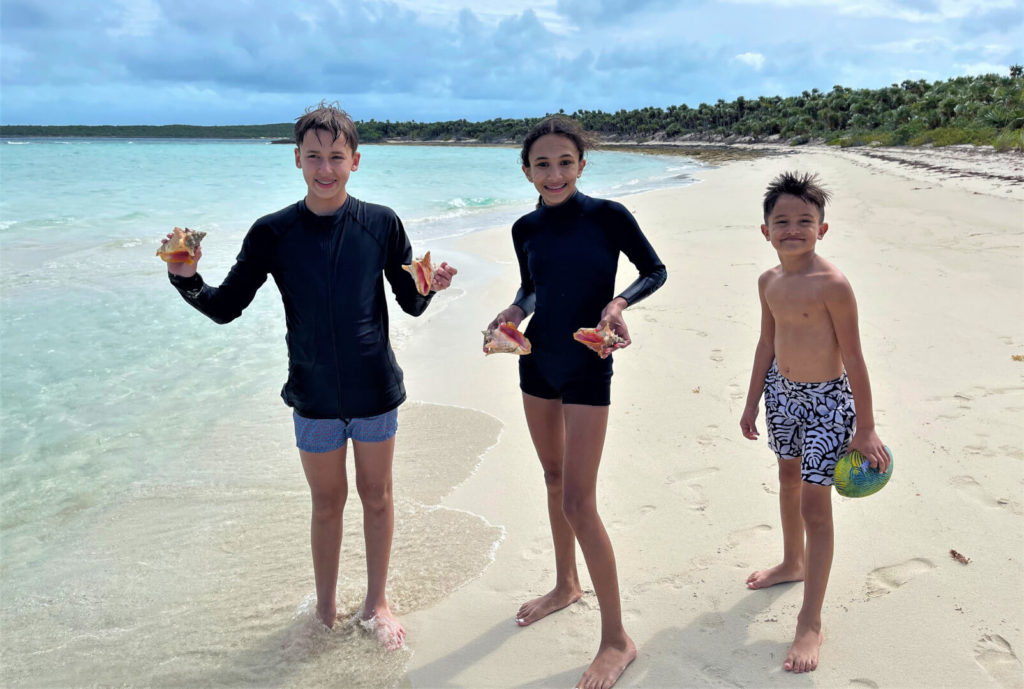
The kids found some conch off the beach at Pasture Cay. I reminded them that:
- There is no taking in the Exuma Cays Land and Sea Park
- Conch must be large enough to have a ‘fully formed lip’
So they put the conch back from whence they came.
Sandbar
At the north end of O’Brien’s Cay, near the Aquarium, there is a shallow bay. A sandbar surfaces in the center of the bay at low tide. FWIW, we never saw a truly white sandbar anywhere, all the sand we found was brownish. But there are a number of sandbars throughout the cays at low tide.
Services Within the Exuma Cays Land and Sea Park
Aside from the park office at Warderick Wells, the park is undeveloped. The park fees, overpriced t-shirts, and a few bags of chips available for sale at the park office are the full extent of what is available for purchase anywhere insite the park boundaries. Fuel, water, provisions, and restaurants are not available inside the park boundaries.
There are also zero cell phone towers in the park. Cell service is provided from towers at Highbourne Cay and Staniel Cay. So, service fades as you get closer to the center of the park, with no service at all available at Warderick Wells. On other islands, we got the best service when anchored by placing a phone on the flybridge and using it as a hotspot for devices inside the boat. Keep this in mind for weather planning and check for weather updates anytime you do have service; when at Warderick, you can get weather updates at the park office.
Final Word on the Exuma Cays Land and Sea Park
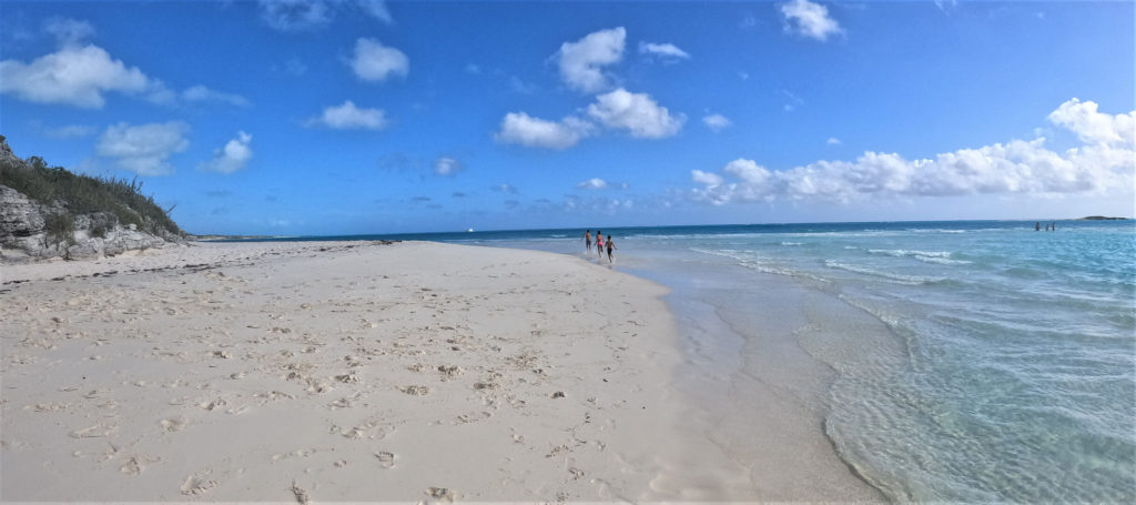
Our three-day exploration of the Exuma Cays Land and Sea Park was relatively superficial. You could spend weeks exploring the anchorages, hiking the trails, and snorkeling the reefs here and not see it all. Do not pass up the chance to drop anchor in the park if you ever find yourself fortunate enough to be boating anywhere near this little slice of heaven for any amount of time.
Next week we’ll be exploring the adventures that lie south of the park towards Staniel Cay. Until then, be sure to read about our experience north of the park here as well as our overview of the Exuma Cays here.